ArcticNet Figures
canadian-arctic
climate-change
arcgis-pro
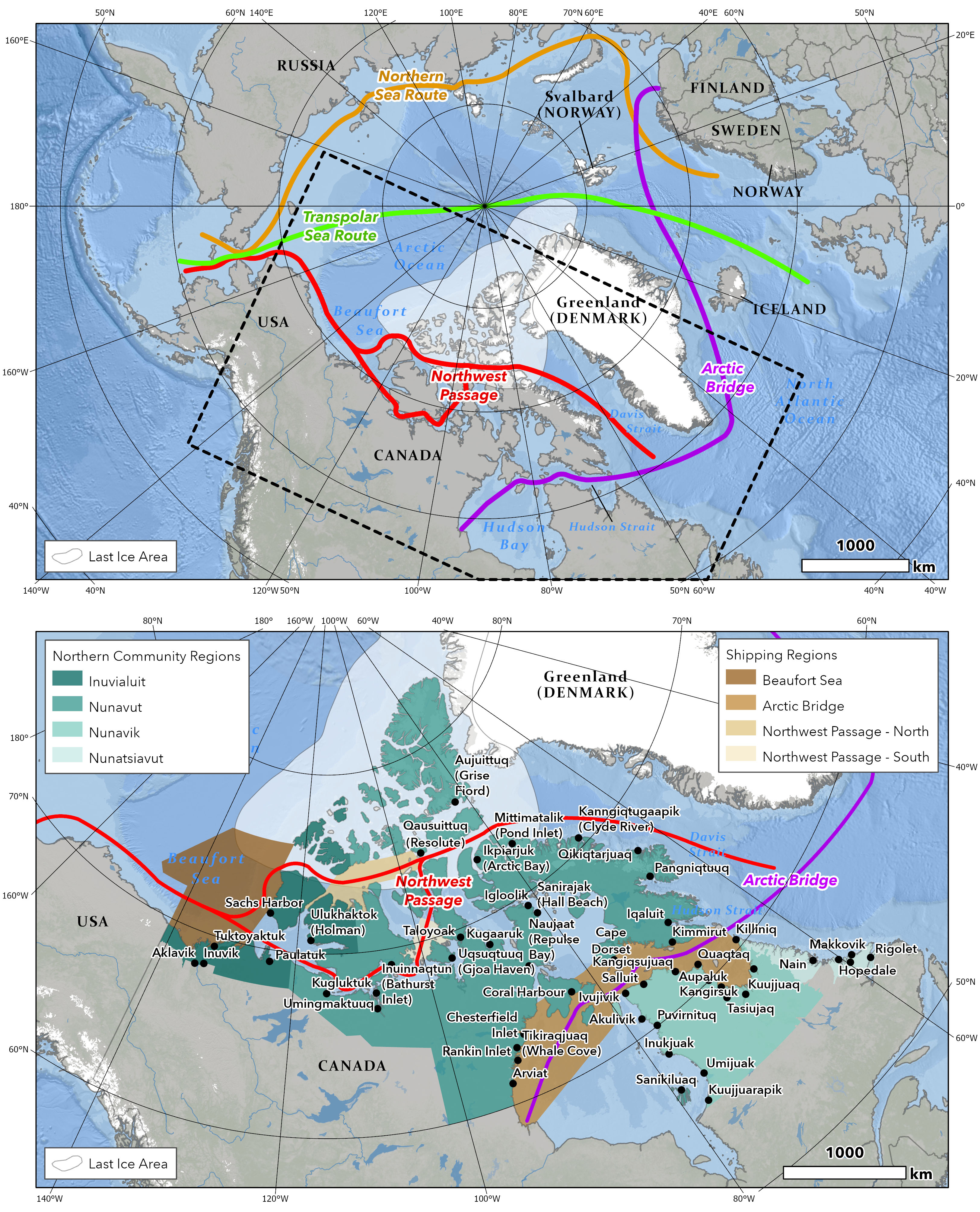
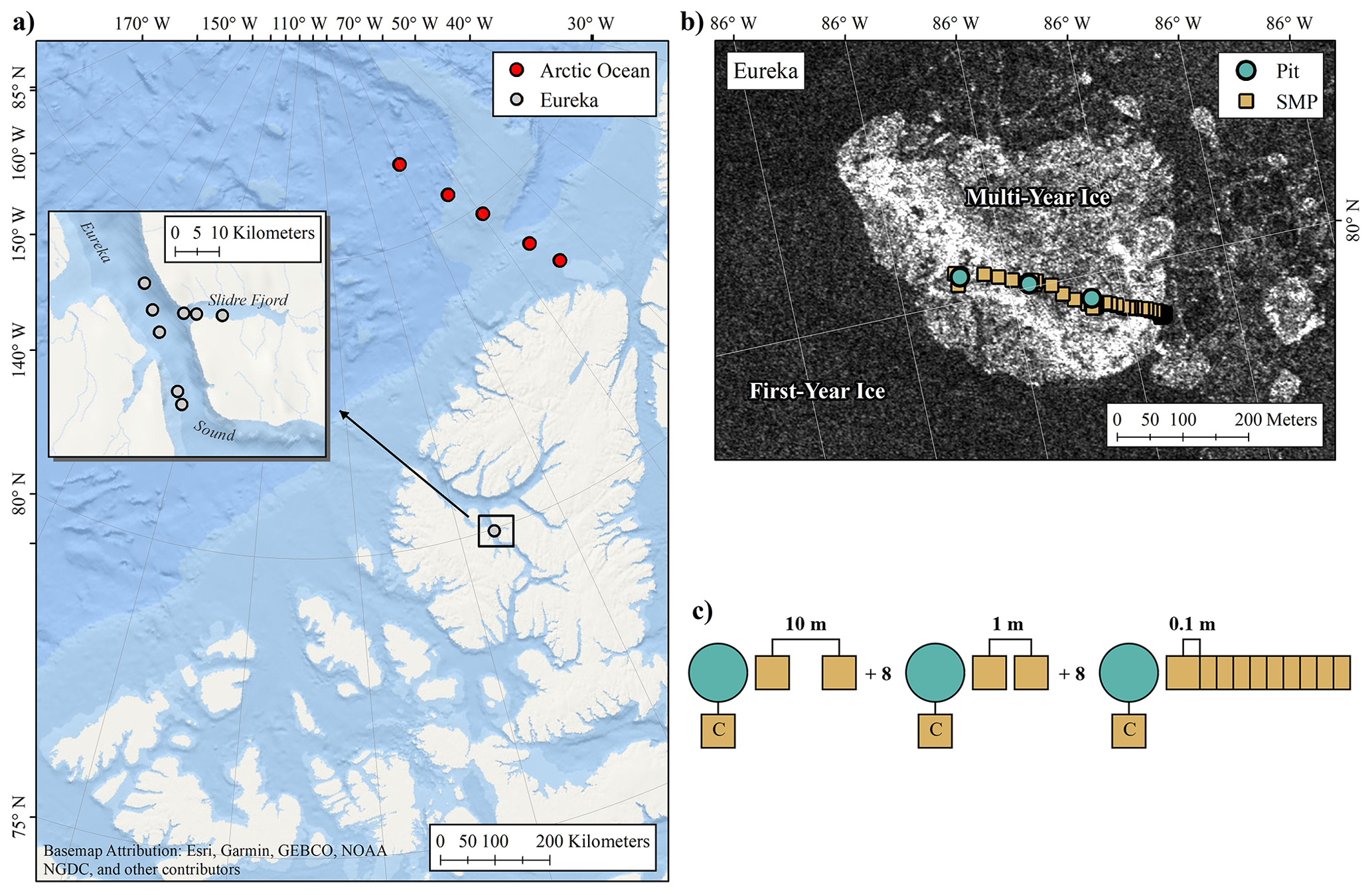
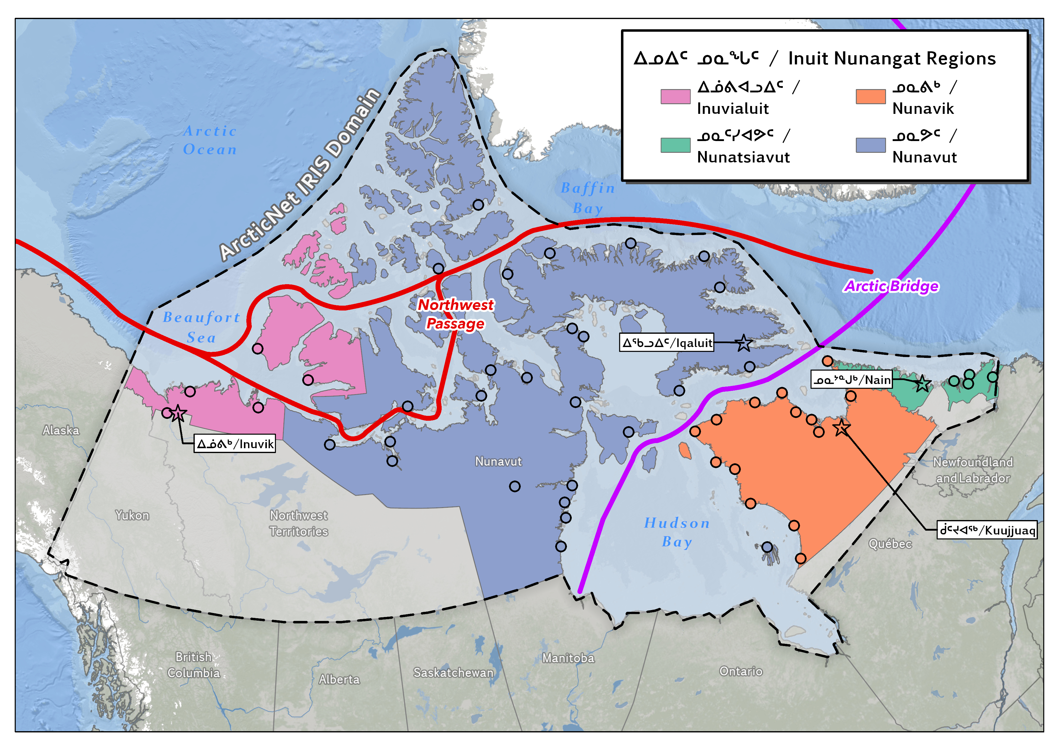
Map figures created for presentation at ArcticNet Scientific Meeting 2022
Feb 17, 2022
Below you can find a curated collection of my maps and figures. Most maps are created through desktop GIS (QGIS, ArcGIS Pro) but graphs and figures usually Python.